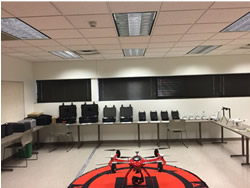
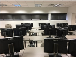
Facilities
Lamar University Geospatial Center which located in the Department of Earth and Space Sciences is equipped with state-of-the-art technologies:
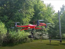
- ICI HALO PRO Drone with improved flight performance and better loading capacity to carry multispectral and hyperspectral camera systems
- DJI Phantom4 Pro Drone System
- Sony R10C High-resolution visible multispectral camera systems
- Two 640 P-Series Short Wave Infrared (SWIR) UAV camera system
- Two 9640 P-Series/USB Calibrated Thermal Camera with Temperature Measurement system
- Methane Mapper sensor that is being used for collecting concentration data at 2 Hz
- UAV LiDAR System for topographic mapping and 3D terrain analysis
- GSMP-25U Potassium Drone Magnetometer
- RS-5400 VNIR&SWIR Portable Field Spectroradiometer
- 20 powerful Dell Precision Workstations
- HP 4650dn Color LaserJet printers
- Epson Stylus Pro T7000 wide-format (44 inch) color printer
- Vidor Select P42 wide-format (42 inch) color scanner
- ENVI image analysis software (Harrisgeospatial)
- ArcGIS 10.x and ArcPro for Desktop (ESRI) with extensions that include Spatial Analyst, Geostatistical Analyst, 3D Analyst, Network Analyst, Tracking Analyst and Publisher